
Welcome to AstrologyOz
Apologies to all those who rely on this resource.. I have had major server issues which are now hopefully fully resolved.... after 4 months... I will be updating everything over the next week .... so thanks for your patience :)
|
|
|
World
News 2014
|

|
All your planetary data for 2014 is here now Planetary stations , Void of Course Moon , Moon phases and Planet Ingresses for 2014 plus Moon Planting Guide |

|
Jan - April 2014 Planting Guide
,
plus 2014 Moon phases,Planet Ingresses and retrogrades,
|
Mapping Australian astrocartography lines on your birth chartAstrocartography is one of the most talked-about techniques in modern astrology. Every planet aspected at your birth casts a line across the globe, and where that line falls on a map tells you something about how that planet's energy expresses in that part of the world. Australians find the practice especially interesting because the country sits so far south that lines often land in unexpected places compared to charts drawn for friends in London or New York. Whether you're curious about a move from Melbourne to Bali, wondering why a Sun line runs through your favourite surf beach, or mapping the family home where you grew up in Adelaide, the maths behind the lines is the same for everyone. You only need a few accurate pieces of information and a reliable mapping program. This guide walks through the practical steps for working out your own Australian astrocartography lines, including the local time quirks that catch out a lot of people trying to plot their chart from Perth to Cairns. Gathering your exact birth coordinatesAstrocartography needs three pieces of birth data: date, exact time, and place. Lines are plotted by the latitude and longitude where you were born, and small differences can shift a line by a noticeable margin across a country this size. Time of birth is often a sticking point. Many Australian hospitals only recorded to the nearest five minutes, and rural births sometimes rely on a parent's watch. An estimate within ten minutes gives you the right zodiacal degree for your planets, which is what the lines are calculated from. If you were born during daylight saving months, check whether your state observed it. New South Wales, Victoria, Tasmania, the ACT and South Australia usually do, while Queensland, Western Australia and the Northern Territory don't. A baby born at 2:15 am in Brisbane in January was actually born at 3:15 am Sydney time, which shifts the whole chart once you convert to Greenwich Mean Time. Choosing mapping software that handles southern latitudesMost commercial programs were built with North America and Europe in mind. They still work fine for Australia, but the southern hemisphere layout can look unusual if you're used to maps centred on Europe. Look for software that lets you flip the projection, adjust the orb width of each line, and toggle between paran and standard lines. A default orb of around 800 km is a useful starting point, but narrowing it to about 500 km can show how a line interacts with specific cities such as Hobart or Cairns. If you plot by hand using an ephemeris and a world atlas, remember that Australia sits above the equator only in a small sliver near Cairns and the Torres Strait. The bulk of the continent lies between 10°S and 44°S, where most of your planetary lines will land. Plotting the planetary linesOnce your birth chart is cast, each planet's declination and zodiacal position feeds into the calculation. The software projects those points onto a world map, drawing a line wherever the planet would have been exactly on the zenith, the nadir, the ascendant, or the descendant at the moment you were born. The zenith and nadir lines, sometimes called MC and IC, run roughly north-south through your birth longitude, while the ascendant and descendant lines run east-west. Plotting all ten planets leaves a tangle of lines across every continent. The slow movers, including Saturn, Uranus, Neptune, Pluto, Chiron and the lunar nodes, tend to define the bigger life themes, while the Sun, Moon, Mercury, Venus and Mars lines speak more to daily mood and short-term opportunities. Reading the angle and orb of influenceEach line carries the quality of the angle it represents. A Sun line on the ascendant feels different from a Sun line on the descendant in your natal chart, with the former amplifying vitality and self-expression and the latter leaning into partnerships. When reading an Australian map, remember that the angles behave in mirror image compared to charts drawn for the northern hemisphere. The ascendant still rises in the east, but the sun tracks across the northern sky at midday in places like Sydney or Perth, which means MC lines fall on the opposite side of the map from what you might expect. You can see this reflected in transit work too. The way planetary ingresses affect your daily energy levels makes the same principle clearer: a planet's angle on your chart tells you where its energy is most felt in everyday life. Cross-checking with local time zone quirksAustralia's time zones span three standard offsets plus daylight saving in the south-east. AWST is UTC+8, ACST is UTC+9:30, and AEST is UTC+10, with an extra hour during daylight saving months in NSW, Victoria, Tasmania, the ACT and South Australia. If you're cross-referencing your astrocartography with a relocation chart for a move from Sydney to Adelaide, the half-hour time difference can shift the house cusps slightly. Tasmania observed daylight saving from 1967, New South Wales from 1971, and the rules have shifted several times since, so an outdated time zone table can place your Moon line in the wrong hemisphere entirely. Quick reference for places and toolsA few Australian locations come up again and again when people plot their lines, and the right tools make the maths far easier to handle. Where lines tend to cluster across Australia:
Tools that make the maths easier:
The southern hemisphere angle is worth thinking about for any specific transit. The Mercury retrograde article explores this in more depth and pairs well with this guide. Pop your details into one of the free mapping tools above and see where your lines fall across the country. For a more personalised look at your Australian astrocartography chart, browse the rest of AstrologyOz for moon phase tables, planetary station dates, and other resources that pair well with relocation work. |
|
|
|
Benedict
XVI resigns 2013
|

|
|
|
Election
2013- take 2
|

|
|
|
Turkey
Unrest 2013
|

|
|
|
Election
2013
|

|
|
|
World
News 2013
|

|
|
|
Serialised
story of the greates ship of her time and
|

|
|
|
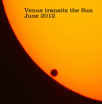
Venus
transits the Sun
|

|
For all your horoscopes, we recommend Ed Tamplin's excellent astrology site.

|
Astrology Oz is best viewed using firefox, screen resolution 1280x1024, macromedia flash enabled.
Firefox - the only browser that gives total control over web browsing, see what you want to see - download firefox

© AstrologyOz 2014
All articles and images on this site are subject to copyright and may not be copied, stored or modified in any way.
AstrologyOz - designed and maintained by Sherrynne Dalby